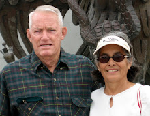
Odus and Joanne had two of their grandkids that week.

These is the other couple that we had met 3 years ago on the west coast. This is Odus and Joanne Howard. Odus and Joanne and Harrell and Sandy have traveled together for many years and they are good friends. When we met them the first time, we met them at Leavenworth, WA and again at La Conner, WA, Seaside, Whaler's Rest, South Jetty, OR and Isleton, CA. We had a good time at that time and we went and saw them crabbing. That was good crabs.

I guess this RV has seen better times.


Some more barns.

When we came out of the park to go to town, these guys from a prison unit were working on the road.


These are our friends Harrell and Sandy Robbins from CA.

This is our campsite and our friend's. Most of the time we were here we were working on something. At Redding, CA we thought we would stay at a Walmart but when we got there, we found out it was a smaller Walmart and there was no room for anything. After trying to get out of there and on a turn, our Monico mud flap fell off. I guess we had run over some pieces of tires that the 18 wheelers leave on the road and somehow we probably dragged it a long way together with our mud flap. When we got to Walmart we discovered that it was totally destroyed. It was covered in oil and all the rubber from where it attached to the flap frame was all chewed off. We kind of redid it and put it back up but we don't know if it's going to work. We played games every night outside so that is why this lamp is there. We had fun.

I thought this was a cute little house on top of a hill just outside the park.

An then we saw some wild turkeys. There were probably about 12 to 14 in all.

First thing we saw when we entered the park.

After a long rinky dinky road we got to TT Lake of the Springs Park. We are suppose to meet with 2 couples that we met three years ago on the west coast.

We stopped here at Chico because Tommy noticed that we were leaking oil. We unhooked and found a Walmart and found some synthetic oil. We bought 6 gallons but only put in 2.

This was a pretty long bridge.

We didn't know what these colorful things were until we got closer. They are all bright colored water trucks. I'd never seen trucks in those colors but maybe Californian people have.

Mount Shasta.

Stopped here for a few minutes to check everything out.

 Odus and Joanne had two of their grandkids that week.
 These is the other couple that we had met 3 years ago on the west coast. This is Odus and Joanne Howard. Odus and Joanne and Harrell and Sandy have traveled together for many years and they are good friends. When we met them the first time, we met them at Leavenworth, WA and again at La Conner, WA, Seaside, Whaler's Rest, South Jetty, OR and Isleton, CA. We had a good time at that time and we went and saw them crabbing. That was good crabs.
 I guess this RV has seen better times.
 Some more barns.
 When we came out of the park to go to town, these guys from a prison unit were working on the road.
 These are our friends Harrell and Sandy Robbins from CA.
 This is our campsite and our friend's. Most of the time we were here we were working on something. At Redding, CA we thought we would stay at a Walmart but when we got there, we found out it was a smaller Walmart and there was no room for anything. After trying to get out of there and on a turn, our Monico mud flap fell off. I guess we had run over some pieces of tires that the 18 wheelers leave on the road and somehow we probably dragged it a long way together with our mud flap. When we got to Walmart we discovered that it was totally destroyed. It was covered in oil and all the rubber from where it attached to the flap frame was all chewed off. We kind of redid it and put it back up but we don't know if it's going to work. We played games every night outside so that is why this lamp is there. We had fun.
 I thought this was a cute little house on top of a hill just outside the park.
 An then we saw some wild turkeys. There were probably about 12 to 14 in all.
 First thing we saw when we entered the park.
 After a long rinky dinky road we got to TT Lake of the Springs Park. We are suppose to meet with 2 couples that we met three years ago on the west coast.
 We stopped here at Chico because Tommy noticed that we were leaking oil. We unhooked and found a Walmart and found some synthetic oil. We bought 6 gallons but only put in 2.
 This was a pretty long bridge.
 We didn't know what these colorful things were until we got closer. They are all bright colored water trucks. I'd never seen trucks in those colors but maybe Californian people have.
 Mount Shasta.
 Stopped here for a few minutes to check everything out.


 Mount Shasta in California.
 We stopped here for a minute just to let them know that we didn't have any fruits or vegetables or whatever. I guess it was an inspection station.
 Another one of them barns.
 These were advertising signs at Dorris CA which was really neat cuz it looked like a flag from a distance. Of course when I was trying to get the picture I didn't get the whole thing. They had one of them flags at the entrance and another one at the exit of the little town. I didn't get that one either.
 We just crossed over into California from Oregon.


 We heading to Klamath Falls here. We thought we were going to spend the night but we kept on trucking into California.


 The Visitor Center.